A Bright Spot at Mount Michael
15 min read

⚖️
Open Journalism · PUBLIC_DOMAIN
Published under PUBLIC_DOMAIN by NASA
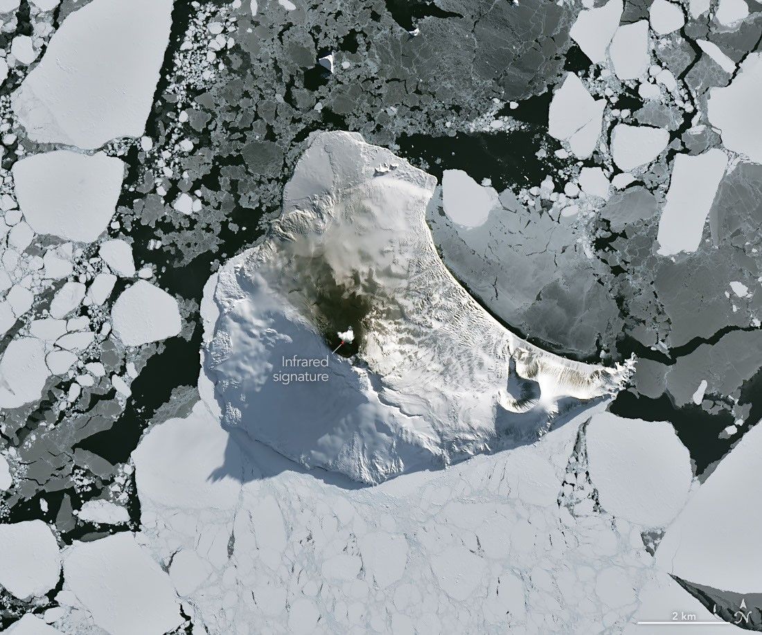
Winter near the Antarctic Circle brings months of frozen darkness, when sea ice chokes ocean waters and many of its denizens hunker down to ride out the harsh conditions. But as winter began to release its icy grip, an uncommonly clear satellite image revealed that part of this remote realm was still very much awake, at least volcanically speaking.
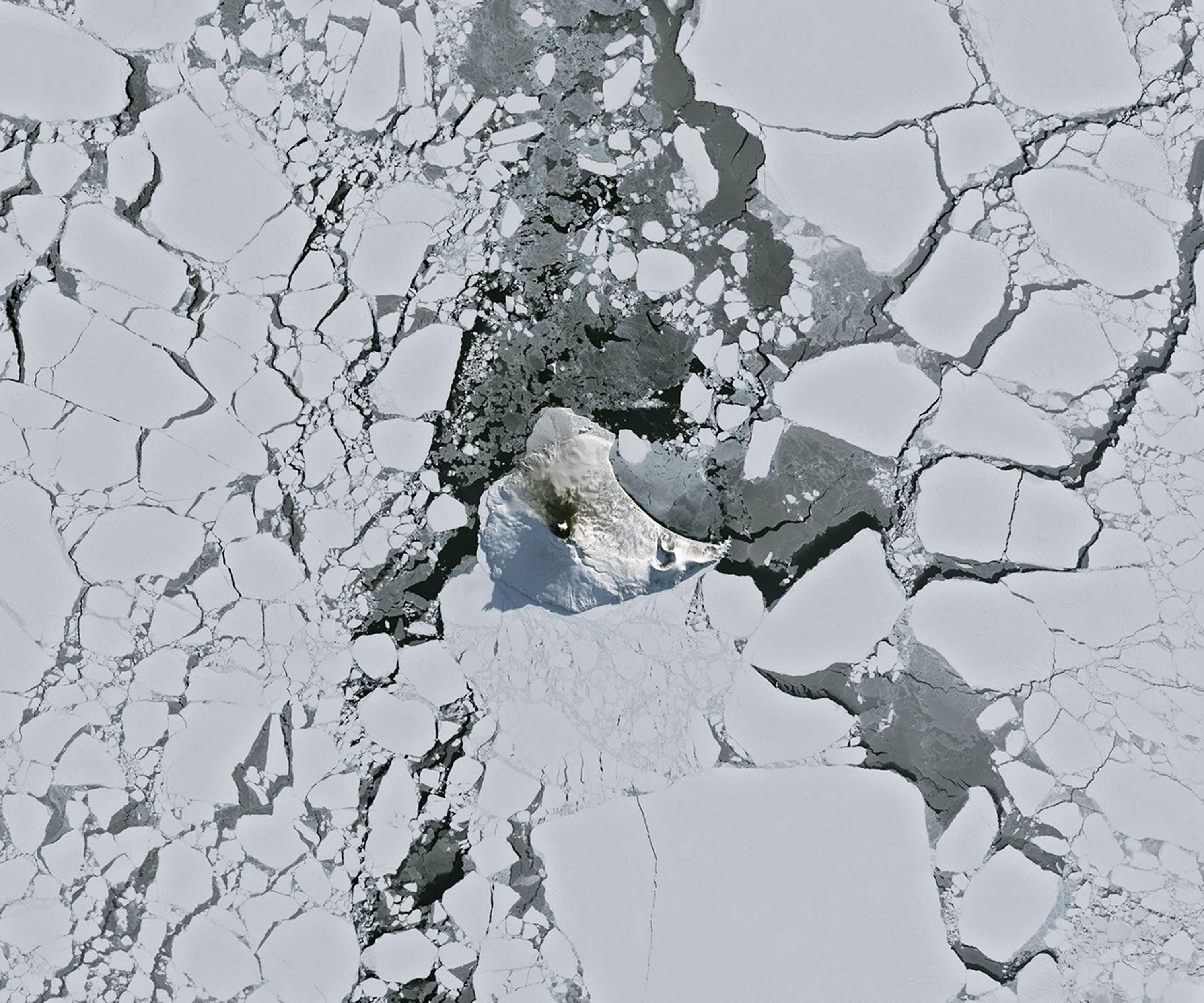
Mount Michael, the stratovolcano at the center of Saunders Island, rises above the ice-filled South Atlantic Ocean in this image, acquired with the OLI (Operational Land Imager) on the NASA-USGS Landsat 8 satellite on August 24, 2026. The natural-color image is overlaid with an infrared signal (OLI bands 7-6-5), shown in red, revealing heat from the persistent lava lake in its summit crater. A puff of a volcanic plume hovering over the peak, along with darkened snow on its northern slopes, also suggests ongoing activity.
Saunders Island is one of the South Sandwich Islands, a string of small volcanic peaks about 350 kilometers (220 miles) long that formed from the South American plate subducting beneath the tiny South Sandwich plate. Regular eruptions, including at Mount Michael, have occurred on these islands in recent centuries.
Because of the volcanoes’ remoteness, scientists rely on satellite data to understand their activity. An analysis of thermal anomalies in Landsat, Sentinel, and ASTER (Advanced Spaceborne Thermal Emission and Reflection Radiometer) observations spanning 30 years led researchers to conclude that Mount Michael hosts a persistent lava lake in its summit crater. Only a handful of other volcanoes on Earth, including Kīlauea, Nyamulagira, and Erta Ale, are known to have similar, frequently active features.
Thermal observations from the MODIS (Moderate Resolution Imaging Spectroradiometer) and VIIRS (Visible Infrared Imaging Radiometer Suite) instruments have also enabled long-term monitoring of Mount Michael. Data provided through MIROVA, a near-real-time volcanic hot spot detection system, indicate that low-intensity activity has been ongoing at the volcano for the past several years. Other observations from NASA’s Aura satellite show that emissions of sulfur dioxide and other gases are common at Mount Michael.
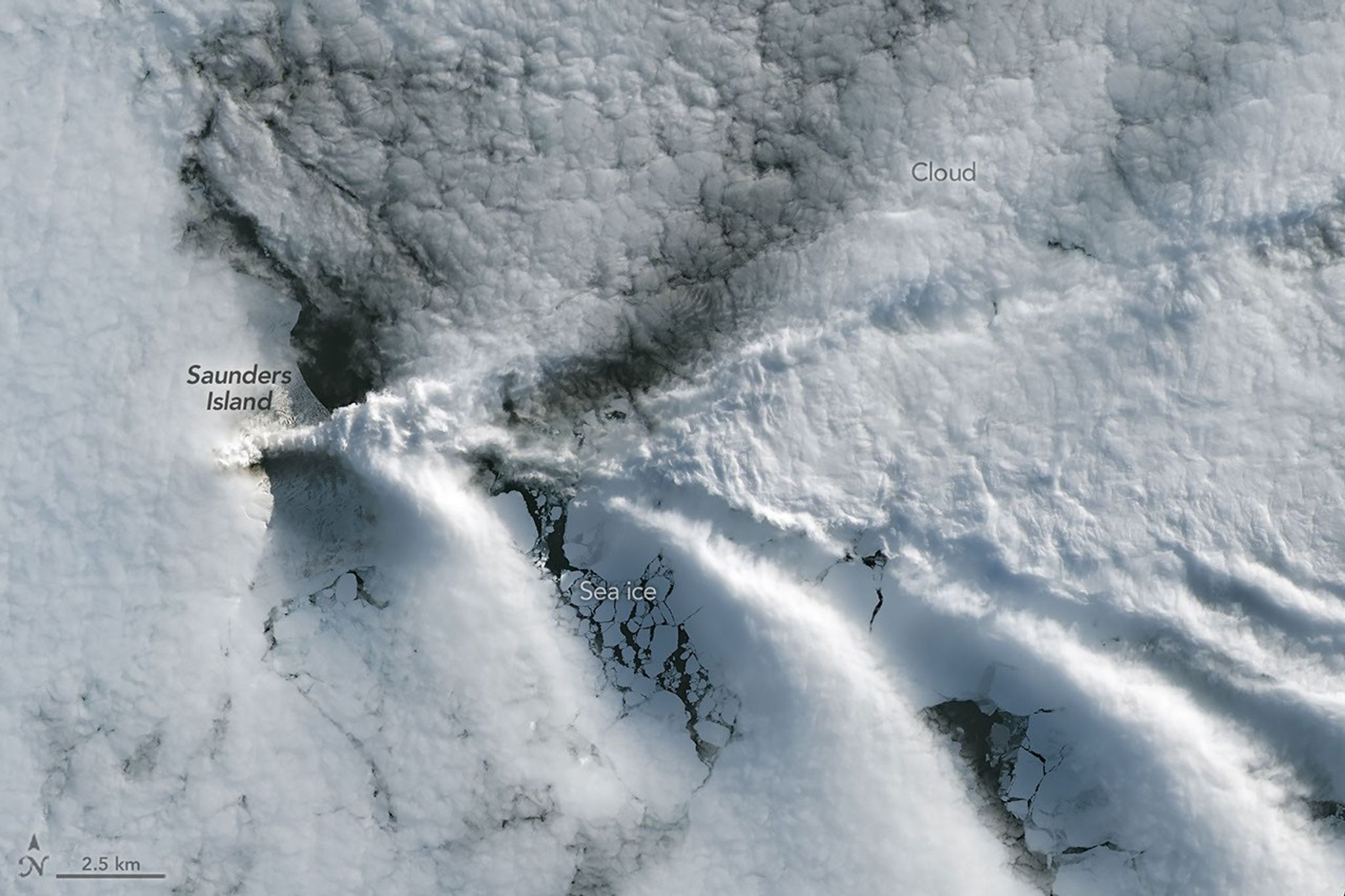
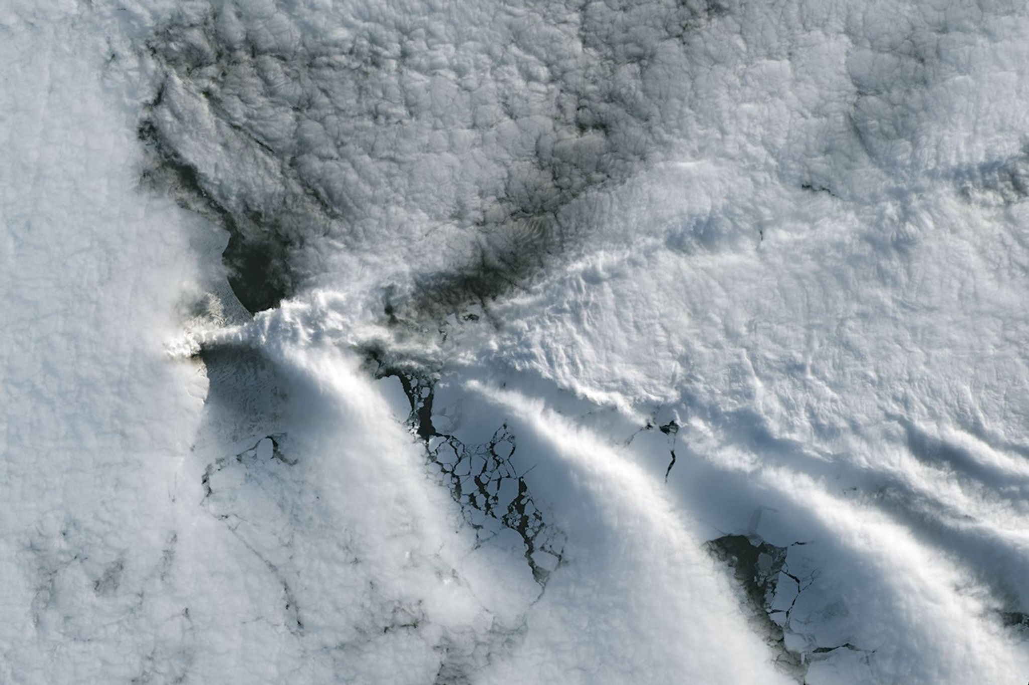
The cloud-free window over Mount Michael would close in short order. One week later, when Landsat 9 passed over the island, a more active atmosphere had returned. But the weather patterns interacted with the island to put on a spectacle of their own. The 843-meter-high (2,766-foot-high) peak jutting from the ocean disturbed passing winds to produce a series of wave clouds resembling the wake of a ship, a familiar phenomenon in this region. False-color imagery captured by NASA’s Aqua satellite indicates that a volcanic track caused by degassing sulfur dioxide was likely present as well.
NASA Earth Observatory images by Michala Garrison, using Landsat data from the U.S. Geological Survey. Story by Lindsey Doermann.
References & Resources
- Global Volcanism Program (2026) Saunders. Accessed September 4, 2026.
- Gray, D.M., et al. (2019) Evidence for a lava lake on Mt. Michael volcano, Saunders Island (South Sandwich Islands) from Landsat, Sentinel-2 and ASTER satellite imagery. Journal of Volcanology and Geothermal Research, 379, 60-71.
- MIROVA (2026) Michael. Accessed September 4, 2026.
- NASA Earth Observatory (2020, June 23) Volcanic Emissions Can Change Clouds. Accessed September 4, 2026.
- NASA Earth Observatory (2020, February 28) Sandwiched Wave Clouds. Accessed September 4, 2026.
- NASA Earth Observatory (2019, July 19) Lava Lake Discovered on Mount Michael. Accessed September 4, 2026.
- NASA Earthdata (2020, July 28) Sensing Remote Volcanoes. Accessed September 4, 2026.
You may also be interested in:
Stay up-to-date with the latest content from NASA as we explore the universe and discover more about our home planet.

Ever Restless Mount Dukono Erupts
2 min read
The volcano on Indonesia’s Halmahera Island routinely ejects ash, volcanic gases, and volcanic bombs.
Article
A Sea of Spinning Clouds
3 min read
Icy, isolated Peter I Island stirred up a show in the atmosphere off the West Antarctic coast.
Article
America’s Emerald Isle
3 min read
Beaver Island is one in a string of verdant and scenic jewels in a northern Lake Michigan archipelago.
Article




60
Related Articles

Phys.org·16h ago·Science
High-resolution weather data could pinpoint neighborhoods facing greatest heat stress
Heat stress is a leading cause of weather-related deaths and can be especially dangerous in cities, where phenomena like urban heat islands drive temperatures higher than in surrounding rural areas. Now, a new dataset developed by the U.S. National Science Foundation National Center for Atmospheric…

Phys.org·16h ago·Science
New species of 240-million-year-old prehistoric animal could reshape dinosaur origins timeline
A new prehistoric animal species from Tanzania dating to around 240 million years ago, during the Triassic period, has been described by an international team of researchers. Led by the University of Bristol, the new species, named Dinodontosaurus isiyavamanda, could help scientists refine the age o…

Phys.org·17h ago·Science
Weather forecasts are significantly less accurate in poorer countries, analysis finds
Weather forecasts inform countless everyday decisions—from farmers deciding when to sow crops and energy companies anticipating demand to public authorities preparing for heat waves. But how useful those forecasts are depends considerably on where people live.

Phys.org·17h ago·Science
Young, eco-anxious Canadians are the most likely to support disruptive tactics by environmental activists, study finds
The tolerance of individual Canadians for radical forms of environmental activism depends on several factors. Overall, however, Canadians do not support vandalism or violence as forms of protest. Those are the key findings of a new study by researchers from McGill University and Université Laval. Th…